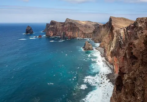
The easternmost point of Madeira features dramatic volcanic rock formations and contrasts sharply with the island's green interior. The PR8 hiking trail offers spectacular coastal views across multicolored rock layers.
Getting there and back
Which route
Where to board
Route 702 runs east from Funchal through Machico and Caniçal to Baía d’Abra. Open the route page for its Funchal stop list and the timetable and source.
From the stop
Baía d’Abra is the end of the road: the PR8 trail starts at the car park where the bus turns. There is no village, shade or shop here.
The way back
Only route 702 returns from Baía d’Abra. The last departure sets the length of your hike: read it on the route page before you start, and allow for the walk back to the car park.
Good to know
- Check the official trail status before setting out; the peninsula is exposed and windy, with no water on the trail.
Bus access does not establish whether a trail is accessible. Consult the official trail and reservation sources before setting out.
Choose the return transport before the walk; the route page carries the bus timetable and its source.
Visit Madeira — trail informationWhat to see at Ponta de São Lourenço
Hike the PR8 trail (4-5 hours return) for stunning views of vertical cliffs and hidden bays. Best visited in spring for wildflowers. Bring water and sun protection as the peninsula is exposed and arid.
Best time to visit
Spring (March-May) for wildflowers and moderate temperatures. Avoid midday heat in summer. The peninsula can be windy year-round. Clear days offer the best coastal views.